(Images fixed)

(click to view full)
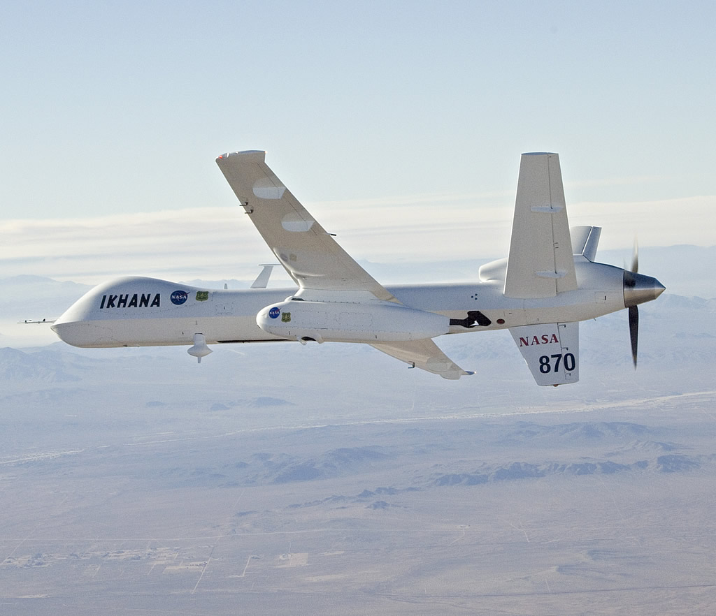
A recent DID article explained the differences between the smaller MQ-1 Predator and MC-1 Sky Warrior UAVs, and their more advanced, higher-altitude cousin the MQ-9 Reaper hunter-killer. The MQ-9 is also the basis for other UAVs, some of which are used for research. One is NASA’s Ikhana unmanned research aircraft (pron. ee-kah-nah, Choctaw language, means “intelligent”). NASA has also been intelligent, running wildfire related exercises and missions since August 2007. Ikhana flew over several of the Southern California wildfires on Oct 24/07, using its payload capacity to carry special thermal-infrared imaging equipment that can look right through smoke and haze, and record high-quality imagery of key hot spots.
(click to view full)
Each flight is being coordinated with the US Federal Aviation Administration, in order to allow the remotely piloted aircraft to fly a safe and empty path in national civil airspace. The imagery is processed on board, downlinked, and overlaid on Google Earth maps at NASA Ames Research Center in Northern California. From there, the National Interagency Fire Center makes it available to incident commanders in the field, so they can assign their fire-fighting resources more intelligently. The mission is controlled by pilots operating from a ground control station at NASA’s Dryden Flight Research Center at Edwards Air Force Base, CA. The above 3-D image was taken at 10:21 a.m. PDT over the Harris Fire in San Diego County, looking west. The hot spots (in yellow) are concentrated on the ridgeline in the left center of the photo.
Nice work. The UAV continued its flights Thursday, and more MQ-9 Ikhana images can be found via this NASA page. You can also look at Ikhana’s page of past photos, which includes one detailing its wildfire sensor package.
This kind of dual civil/military capability will become more common in future, as UAVs are fitted with equipment that lets them operate safely in civil airspace.